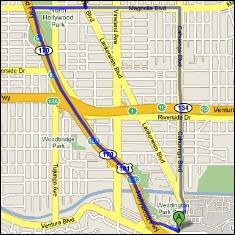
BROOKE GLADSTONE: I once worked in an office which opened into a hall. My boss was in the next office. Once, as I was leaving, I heard him suppressing laughter. Why? Because every single time I walked out my door, I turned in the wrong direction and had to double back. I am very directionally challenged, so I live by Google Maps. A Pew research report last week found that 74 percent of smart phone-owning adults use phone apps to get information based on their location - restaurants and shops and, most important for me, which way to walk.
NAVIGATION VOICE: Turn left. Turn right. You've arrived at your destination.
BROOKE GLADSTONE: But, as the Ancients asked, does the walker choose the path or the path the walker? A recently launched website called Ghetto Tracker affixes safety ratings to specific areas on maps, so you can avoid walking into a neighborhood it deems dodgy, as its controversial name implies. But geographer Jim Thatcher notes that other navigational apps do pretty much the same thing, in ways far less blatant than the folks at Ghetto Tracker.
JIM THATCHER: Certain people are saying these areas are, quote, unquote, “ghetto” and that you should avoid them. You don’t know who those people are. You don’t know their motivations, but that’s where it’s coming from. What’s interesting to me is that Ghetto Tracker got so much attention, whereas we already have tools that are doing the same thing but are using algorithms to do it, and no one is talking about those.
BROOKE GLADSTONE: You think that's worse than an individual going, “Wow, there’s a lot of people here of color, I’m gonna warn people to stay away”?
JIM THATCHER: [LAUGHS] I don't – okay. With Ghetto Tracker, it’s really clear that they’re doing that. With these other ones that have a non-publicly-accessible algorithm, it’s hidden what they're doing.
BROOKE GLADSTONE: Microsoft issued a patent in 2012 called Pedestrian Route Production. The media dubbed this project as “the avoid ghetto app.” My understanding is that the app bases its algorithm on weather, crime statistics and demographic information. Since users don't know what data specifically the app is pulling from, that's where your problem is?
JIM THATCHER: Yes. Microsoft may or may not ever put this technology into one of their products, but we have no way of knowing that these decisions are being made. How are they using demographic information? Are they saying, well, this area has a median income of X, therefore, this user with an income of Y would not like to go there.
BROOKE GLADSTONE: This past July, it was announced that Waze, W-A-Z-E, which is a geographic navigation app, was bought by Google for $1.3 billion. So why are they worth so much money?
JIM THATCHER: Waze, at its core, provides real-time traffic updates by collecting information from its 40 million users. When they turn the app on, they start monitoring where you’re going and what speed you’re traveling at. I’m sure they grab other information, as well. Google already could do that on any phone that was running Android. So why are they willing to pay so much to buy Waze? Well, anytime you can add 40 to 50 million new sources of data, that’s incredibly valuable.
BROOKE GLADSTONE: We are being sold for our data. It's an old story.
JIM THATCHER: Mm-hmm.
BROOKE GLADSTONE: But I still wonder how it might affect our route.
JIM THATCHER: I’m on Point A and I want to get to the closest coffee shop. If you’re using Google Maps, it can theoretically say to any five coffee shops nearby, hey, how much are you willing to pay us to send a customer to you?
BROOKE GLADSTONE: It may have the potential, but does it do it?
JIM THATCHER: It's not being used fully right now, but what we’re seeing is a huge jockeying to position themselves to be the best at doing this. The purchase of Waze, Microsoft's patent. There’s this sort of “gold rush” to sort of figure out how to effectively do this.
BROOKE GLADSTONE: So what's the downside here, really, Jim?
JIM THATCHER: Several things. It's very, very easy to remove areas. You can end up alighting entire areas of experience. As these applications route us through cities and around obstacles, whether they’re traffic jams or just areas where someone has paid more to send us down that street, there can be a feedback loop that develops. You're encouraged to behave in a way that is defined by this computer application; it then starts rewarding you.
BROOKE GLADSTONE: So we make fewer and fewer judgments, and I guess that feels good.
JIM THATCHER: Yeah. In the interviews I’ve done of end users of mobile phones, I have found that they often experience a real pleasure in sort of being placed on the map. And, if you think about it, it makes a lot of sense. You don't have to keep in your mind where everything is. You’ve got this thing that does it for you. But what's on the map and what's not becomes decided through this completely hidden process, calculated in the interest of for-profit corporations. And I know a lot of people will always say, oh but, you know, corporations aren’t that bad. Well, there's absolutely no reason to believe that governments couldn’t do this.
BROOKE GLADSTONE: Mm-hmm.
JIM THATCHER: So if that’s your cup of tea –
[BROOKE LAUGHS]
- or your style of paranoia, there’s plenty to be worried about there too.
BROOKE GLADSTONE: [LAUGHS] Jim, thank you very much.
JIM THATCHER: Brooke, it's been an absolute pleasure.
[MUSIC UP AND UNDER]
BROOKE GLADSTONE: Jim Thatcher is a geographer at Clark University.
