
How the Big Storm Landed
[music]
Governor Hochul: It is brutal. It is bone chilling. We warned this to be dangerously cold and it's been unrelenting.
Brian Lehrer: Governor Hochul there. Later, we'll play a clip of Governor Sherrill gloating that it will be a traditional day off from school in much of New Jersey, unlike in New York City today. I know schools are closed in a lot of the region other than the city. We'll talk about that later in the show. Are you one of those people who went out to in the snow yesterday, like the person I saw in New York, one who I think was skiing down 9th Avenue in Manhattan and another one skiing across Atlantic Avenue in Brooklyn, or of course, out with your kids? Are you more the type who was perfectly content to stay indoors, watch the winter wonderland out your window and just stay as warm as you could, and chuckle at other people who were going out in it or had to go out in it because have you been working?
We always try to remember on the show all of you who have to work on days like holidays and during snow and ice storms so everyone else can take a gap, or maybe you're a New York City teacher or a school kid yourself getting ready for a remote learning day or someone from most other school districts in our area which are closed.
We'll talk to NY1 Chief Meteorologist John Davitt to start the show today to explain where our region is at, how it got this way and what happens next with the extreme cold, and then we'll have Comptroller and former Manhattan Borough President Mark Levine on. He'll talk about providing city services to vulnerable people, the really serious part of the storm, as well as general snow and ice cleanup. Also what we originally booked Mark Levine for, he's got some very bracing news for Mayor Mamdani and the City Council about a budget gap that they will have to deal with immediately and the choices regarding city services for all New Yorkers that they may have to face.
Later we will definitely also discuss what's happening in Minnesota with ICE and with the Trump officials lying about the killing of Alex Pretti until they got caught by the video evidence. Even the Wall Street Journal editorial page, which I'll read from later, is saying the Trump administration spin on this just isn't believable, and they're calling for ICE to pause its operations there. That'll be later.
John Davitt, chief meteorologist for Spectrum News, NY1, is with us to explain the conditions outside right now and to help take your calls with your experiences, fun or otherwise since the snow started falling early Sunday morning. John, I know you're a busy guy today in your real job, so thanks for making some time for us, and welcome to WNYC.
John Davitt: Hey, thanks, Brian. It's great to be here. Winter has not been really visiting New York the last few years, and as a meteorologist and snow lover, I've missed it, so yesterday was really cool to see. Today, I think the reality is setting in that it looks pretty until you got to go out in it. Yesterday was something else. Been a long time since we've seen something like that.
Brian Lehrer: We will talk about the long range context of this as we go, but listeners, we'll also get to city services more with Comptroller Levine in a bit, but this first stretch will be on the weather itself and what you've been doing in it. Who has a question for John Davitt? You can call it Ask a Meteorologist. 212-433-
John Davitt: I love it.
Brian Lehrer: -WNYC. Ask a meteorologist anything about meteorology. 212-433-9692. You can call or you can text or help us report the snow and ice story. You know you can do that, too. We can't have a reporter everywhere in the area, so call from anywhere in our region and describe conditions where you are, how much snow, how much ice on top of the snow. How are the roads? How are the trees? Anything you want to report, help us report the story of this storm. 212-433-WNYC. Call or text 212-433-9692.
I'm curious to hear from you if you're anywhere in the city, of course, but also if you're along the Jersey Shore or inland in Jersey, too, or it'd be different than the shore. Curious to hear from you if you're on Long Island where things can be different from the city or up north. Anyone in Newburgh or around there, want to tell us what you got on your block or what people need? 212-433-WNYC, tell us what you've been doing in the snow. Report the conditions on your block or in your area from anywhere in our region or ask John Davitt a question. 212-433-WNYC, 212-433-9692. Call or text. John, how much snow is there, first of all, in various parts of the city that you're watching?
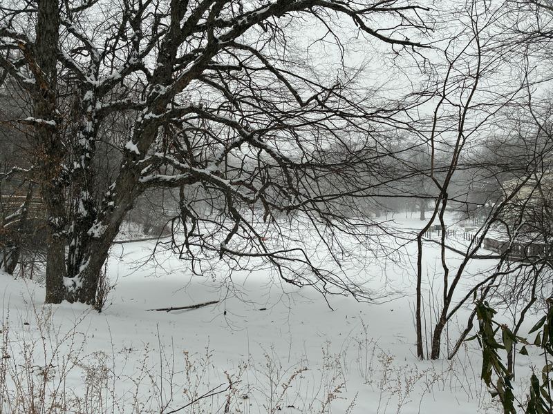
John Davitt: It really does vary quite a bit. If you're in an area where you've got more trees than cars, you probably have about 15 to 18 inches. We're talking Rockland County, we're talking inland parts of Connecticut, we're talking northwest Jersey. All those places they really got the most, 15 to 18 inches of snow. It all came down really fast in an arctic air mass, so it really collected. This was the second weekend in a row where we had a storm, but this one was different because it was so cold. Last weekend it snowed for hours and nothing stuck in most places, maybe a few inches, but this time it was a different ball game for sure.
New York City, that's really my backyard and that's what I focus on. It was the most snow we've seen in four years. I feel a little cheated, Brian. We ended up with 11.4 inches in Central Park. If we had another 0.6, just a little over a half inch, it would have been the most snow in five years instead of four years. The weather geeks were rooting for a foot of snow, so we're looking for that extra half inch.
Yesterday's snowfall for New York City was almost more snow than we saw last year, and it's been an active winter. So far in New York City we've had over 20 inches of snow, and if you add that up, it's almost more snow this winter so far, which is only about half over, than the last three winters combined. There's a lot of cleanup out there for sure. It's an interesting type of snow. When you dig it, you can get the archeology of the storm because when you do that first shovel on the top, it's that hard crust because most of us ended up with freezing rain and sleet. The first shovel is heavy and really crusty, and then after that you get into the powder, and that was the bulk of the storm. As a meteorologist, I felt like an archaeologist as I was doing some shoveling this morning.
Brian Lehrer: I saw you on TV around four o'clock yesterday afternoon, John, saying the snow is about over, but we were in for many hours of ice. Are you measuring that in inches too, in addition to the 11.4 of snow?
John Davitt: No, the 11.4 is the snow and the ice combined. All those numbers come from the National Weather Service. When most people think about measuring snow, they go out to their porch, they go out to the table on their back porch or their sidewalk, and they stick a ruler in the snow and they go, "That's the snowfall."
Actually, the professional way that the National Weather Service measures snow is they have what's called a snow board. This is usually a piece of wood. They put it out and they leave it out in the same location for an hour, and then after an hour they go and measure it. Then they wipe it off, put it back. Next hour they go again, and they go measure it hour by hour. It's definitely different and a little bit more precise than what most people think when it comes to snowfall.
In terms of pure snow, we saw about 8 inches of snow and then it turned over. That was a real surprise. We knew it was going to turn over. I've been forecasting now in New York City for over 30 years, and every storm is a little different, but this one stood out in a few ways. The biggest way it stood out to me was just how cold it was. That arctic air moved in Friday, and in Central Park, we had over 40 consecutive hours where temperatures were below 20 degrees. That is really cold for our area.
During the storm, temperatures were sitting around 12 degrees. That's really unusual for us. Normally if we've got a winter storm, it's 25 degrees, it's 28 degrees, so the °C12 is really unbelievable. I think the biggest question I got from my co workers and people on social media were, "Hey, it's 12 degrees, it's 13 degrees, and it's either freezing rain or little ice pellets, sleet at my house. How is this possible? My 8th grade science teacher said 32 degrees is the freezing line."
You think about it for a minute, I think we can mostly understand that the snow or rain isn't forming at the ground level, it's forming a little higher in the atmosphere. Why it snowed and rained at 13 degrees, was that a little higher in the atmosphere, we had temperatures that were above that freezing line. Really, what we had was rain forming at about 15,000, 20,000 feet in the atmosphere, and then that raindrop fell into that really cold arctic layer and became a frozen raindrop. That's what hit you in the face or bounced out the window. The temperature and getting ice at 13 degrees, that's going to be some memories for me from the storm.
Then the other one is just how long it lasted. We started in Staten Island with some precipitation snow at about 5:00 in the morning yesterday, and at eight o' clock at night, there was still a little bit of precipitation. We're talking about an event that lasted over 12 hours. People always like to complain about plowing. It's a hard job. That's a long time to fight a storm.
The other part of the cleanup this time around, it looks different in everybody's neighborhood, but this was incredibly challenging for anybody who had to be on the snow removal and road treatment side of this equation because of the temperature. We don't have the type of gear and the type of chemicals. The salt and the brining, that's all great, but really, most of our snowstorms and ice events in this part of the country happen 20 degrees or higher. Once you go below 20 degrees, a lot of those chemicals, rock salt and the brining solutions, they're about half as effective. That really hampers the snow-fighting ability.
It may not look great in your neighborhood, but there's a reason. It's not because they didn't try. It's because of the temperature. Really, that's a tough battle to fight a snowstorm in 12 degrees.
Brian Lehrer: On the sleet, listener texts, "I walked through Tompkins Square park, which looks beautiful, frozen in time, quiet and empty, but the snow started to hurt. Around 3:00 PM, it felt like thousands of needles hitting the skin on my face. What kind of painful snow is that?" I think that is the sleet that you're describing, but also, if I got the numbers that you gave us accurately, you're talking about more than 3 inches of ice, of sleet having fallen on top of 8 inches of snow. Did I calculate that correctly?
John Davitt: Yes, your math is right, and the person who commented, they're 100% right. That hurts. We had really strong winds yesterday too. You've got this frozen raindrop that's falling from the upper atmosphere and then being driven by the wind. Now that hurts.
I can remember having a sleet storm at one point in earlier part of my career, and they put me outside. They were like, "Hey, why don't you go outside and cover this?" It was sleet, and to protect the camera, they had to turn the camera away from the way the sleet was coming, which meant my face was going into the camera. Sitting there and trying to talk about the weather while getting pelted with those ice balls, it's interesting.
Somebody on social media called it baby hail, which I thought was funny. Hail, obviously, is also an ice product, but that's usually happens in the summertime with thunderstorms. It's formed by a different process than sleet. Baby hail, that was a new one for me.
Brian Lehrer: I'll have some baby hail with my baby kale. Some reports from around the scene. Listener writes from around the area, I should say, "Cold Spring, New York, we got just under 2 feet of dry soft powder. No ice or sleet crust, so no power outages so far." Another one, this is from a dog owner on the Upper West Side who writes, "We have about one corgi's height worth of snow. Central Park is magical right now. Roads are clear, but sidewalks are piled high. It was a hilly trek for our dog." Yes?
John Davitt: That could be a new way to rate storms. They have category 1, category 2, 3, 4 and 5 for hurricanes. Maybe for snowstorms, we could rate them on the corgi scale.
Brian Lehrer: How many corgis on the corgi scale? Let's get a report from Paul out in Branchville in Sussex County, northwest New Jersey. If you don't know Paul, you're on WNYC. Hey.
Paul: Hi. Longtime listener, first time caller. We have 18 to 24 inches here, and what normally takes about an hour to plow. I'm still doing it. I started at seven o' clock this morning. Just [unintelligible 00:15:13] my own business in my own house. Lots of snow, nice fresh powder.
Brian Lehrer: Paul, thank you very much.
John Davitt: The lakes up there are frozen too, right? Do you ever ice fish up in that area?
Paul: Yes. I used to ice fish. Not anymore.
John Davitt: Exactly. Last winter, I bet you did.
Paul: Yes. I live in Culver Lake, which is the second largest natural lake in New Jersey and it's been frozen for over a month.
John Davitt: That's incredible. I'm going to try and get out, I think next month. I tried last year on a lake in New Jersey. I didn't catch anything, but it was really cool. Do you have the hand-powered auger or the power auger?
Paul: I have a hand-powered auger.
John Davitt: Oh, wow. Going old school. Good for you. Me too. I think that's the most fun part. I don't know if you've ever done it, Brian, but you walk out onto this frozen lake and
Brian Lehrer: I don't even know what an auger is. What is an auger? Tell this kid from Queens.
John Davitt: It's like a corkscrew if you're going to open a bottle of wine. It's got a curvy blade and then you put it against the ice. It's probably about 4 feet tall and then you go spin it. It's got a blade and you cut a hole through the ice. While you're out there, the ice is making all these really cool noises. It's a unique experience. I've done it a few times, but I never catch anything. Maybe this year.
Brian Lehrer: Paul, thanks for calling in. With NY1 Chief Meteorologist John Davitt, Heather in Rockaway, you're on WNYC. Hi, Heather.
Heather: Hi. I didn't know I would be on, actually. I just was asking a general question that yesterday it seemed like the snow that was coming down was similar to the manufactured fake snow that they make at ski resorts. I was just wondering why, technically.
John Davitt: That's a great question.
Brian Lehrer: This is the frustration for a lot of kids too. It didn't pack for snowballs and snowmen and stuff, right?
John Davitt: Yes. It's a great observation. I didn't even think about it. I'm a skier and a snowboarder, so I'm familiar with the snow making guns and how that product is. Why it was so similar to manufactured snow, I guess we'll use that word, is when they use those snow guns on the ski resorts, they go and set the humidity levels so that they maximize the amount of water they're using because most of those places have limits on their water, they want to make it as light and fluffy as possible so they can get the most snow for their water usage.
Those guns are adjustable in terms of the humidity settings. With the arctic air in place, that makes for a high snow ratio. At the first half of the storm, normally if you get an inch of water, you get 10 inches of snow, so it's a 10 to 1 ratio. With this event, at the start, at least because of the extreme cold, we were seeing ratios of 15 inches to 1 inch of water or even up to 20 inches to 1 inch of water, especially in some of the northern areas where the cold was more impressive. It's pretty special to see that kind of powdery snow. That's not normal for our part of the country for sure, but that's a great observation. I'm really impressed that that person noted that. That's really great.
Brian Lehrer: Heather, thank you for that. Call us again with more prescient observations or accurate observations. [unintelligible 00:18:59] packing some wise guy notes here that maybe that's why Mayor Mamdani invited school kids to throw snowballs at him for having a remote learning day rather than just a canceled school day today.
Here's a note from someone in the Catskills who writes that mostly it was light and didn't stick on trees. I think they mean the weight of the snow was light and didn't stick on trees. "I checked New York Gas and Electric and there were zero power outages in my county in the Catskills last night, which was positive and rare." That's interesting. We were all anticipating the possibility of a lot of tree branches down, a lot of power lines down, power outages, but I haven't been seeing that in the news, at least not for this region.
John Davitt: I think there's two things at play here. Number one was the type of storm this was. This wasn't a nor'easter with that rapid intensification. People used to like to use that word "bombogenesis". It just means a storm that starts off weak and then turns strong. Those are real windmakers, and that's not what this type of storm was.
In the meteorology world, this storm was a Miller B setup. What that means is that an area of low pressure forms and then it gets to the Appalachian Mountains and then it reforms off the coast. Generally, those are a little bit weaker when it comes to wind. Then the other aspect of this was, it was sleet in terms of the ice and not freezing rain. If this had been a long term freezing rain event, I think we would have seen those power outages, but thankfully we didn't. There's nothing worse than power outages in the wintertime.
Brian Lehrer: Here's a longer range question that's on my mind and it's on Tony-in-Manhattan's mind too. I'm going to let him pose the question to you. Tony, you're on WNYC. Hello.
Tony: Hello, everybody. Love the show. Three quick things. I'm an old snow freak, and in 1961, during the '60/'61 season, we used to go to the Daily News building and stand in front of the weather map the night before the storm. It was this magnificent map and the people would stand there arguing whether it would be sleet, rain, snow.
Anyway, that was one. Number two, I worked in a nursing home, a physician, and there was a hundred-year-old man who told me about shoveling the snow of the Blizzard of '88 in Greenwich Village, which is interesting, which was a March storm for 3 days with sub 10 temperatures in March. The meteorological question is the polar vortex, which seems to explain all of this for the country, is being cited by some as a argument against global warming, but I'd like you to comment as to how the polar vortex fits into the global warming phenomenon.
John Davitt: All great questions. Let's talk about that winter of '60/'61 first. That was a really intense winter. So far this year, we've seen about 20 inches of snow. Normal snowfall for an entire winter in New York City is about 30 inches. That winter 1960/61, we had almost 55 inches, 54.7, so that was a big year. Polar vortex. Some folks call it global warming. The current term really is climate change. I know it launched itself as global warming, but much more accurate to call it climate change because it is our climate changing. Certainly, there's a lot more going on than just rising temperatures. Let's talk polar vortex.
Polar vortex, big picture, it's a closed jet stream pattern. Jet stream are winds in the upper atmosphere. They steer our storms and air masses, so polar vortex is a core of Arctic air that forms every winter. How it relates to the climate change situation is that our global winds, our jet streams, are actually getting slower because of climate change.
Upper level winds are usually-- not usually, but upper level winds are related to the temperature difference between the temperature at the equator and the temperature at the poles. The bigger temperature difference between the poles and the equator, the faster our winds are. When we have fast winds, the polar vortex tends to stay where it belongs up in the North Pole.
What's happening now is we are seeing less of a temperature difference between the equator and the North Pole because of our warming climate. The Arctic is warming four times as fast as the rest of the planet. Because the temperature difference is less between the equator and the Arctic, we're getting slower winds, and that allows our jet stream patterns to become more wavy and that allows the polar vortex to wander further south than it normally would. It also means we get jet stream patterns that sometimes can be stuck for weeks and weeks instead of maybe just a few days. We are going to see that right now in the eastern half of the nation.
Right now we are not expecting to see temperatures go above the freezing mark in New York City for the next 10 days minimum. The 10-to-14 day outlook that goes to about February 8th calls for below normal temperatures throughout the entire East Coast. We're talking about three to four weeks of intense cold. It's interesting to be able to talk about climate change and have it bring colder weather. It doesn't really seem like it makes sense at first until you put all the pieces together, so good topic.
Brian Lehrer: On the climate change aspect, little more on that, I thought this wasn't supposed to happen like this anymore in these parts. There are definitely people, as Tony, the caller was suggesting, who are going to say, "All you people saying global warming, climate change, see." Can you do a little climatology along with your meteorology?
John Davitt: Oh, absolutely. At NY1, every night at 10 o' clock we have a segment called Climate Check, so we're talking climate five days a week. Climate and weather go together for sure.
Let's talk about it. There's climate and then there's weather. Weather is what's happening day to day, climate is what is happening over decades. Usually we're talking about what's been changing over the last 30 years. One hot day, one cold day, one snowstorm, that's not climate, that's weather, but when you put all the numbers together and you average them over a long time, that's what your climate is and that's what we're tracking.
2025 was the third hottest year on record. All right. Great. Maybe it was a one-off. Maybe, that was just a hot year and it's an anomaly. Well, guess what? Then we look in 2024, the year before, that was the hottest ever, and then 2023, the year before that, was the second hottest. The last three years were the three hottest on the planet, back to when we keep records, which is about 175 years.
Again, maybe it's just a short time thing. Then we look and we see that in the last 15 years, all of those years ranked as the top 15 hottest. Now we're starting to get onto a really identifiable trend. Then we go back even further and guess what? We have 588 consecutive months of above average global temperatures. 588 divided by 12 is 49 years. That's where you're getting into your climate and you're seeing that things are changing.
Okay. The climate's changing. What's the big deal there? What we're seeing is that we're getting more intense storms, so more intense heat, more powerful storms. That has a real cost. NOAA, up until this year, was tracking billion-dollar disasters. The current administration has ceased those numbers, but Climate Central, nonprofit, is now tracking them as well. 2025 saw 23 individual storms that ranked as billion-dollar disasters in the United States. That's the third greatest and that is for a year where not a single hurricane even made landfall in the United States.
We are now seeing billion-dollar disasters on average every three weeks in the United States. In the 1980s, it used to be a billion-dollar disaster every three to four months, it's not these one-offs. You put all these one-offs together and you get a trend, and in terms of New York City, things are changing as well. Look out your window and try and think about this fact.
2020, New York City's climate was reclassified as subtropical. Sure doesn't look subtropical out there today, but again, today is a one-off. Overall, our climate was reclassified as subtropical because it's warmer and wetter than it used to be. The extreme weather, we've seen it in New York City, unfortunately, with the severe flooding, of course. In the last 10 years we've seen 5 tropical systems here. 6 of the 10 hottest years ever for New York City all happened in the last 10 years.
New York City weather records go back to the 1800s, about 150 years. We've had three tornadoes, we're seeing wildfires, and of course, we had that Canadian smoke outbreak. The day-to-day storms aren't climate, but certainly climate is something we need to discuss and be aware of.
Brian Lehrer: Here's a question from a listener. They write, "I'm taking some scouts out this weekend and we need to build a fire. Will we be able to build a fire with so much snow?"
John Davitt: Oh, scouts. Scouts are definitely near and dear to me. I'm an Eagle Scout and an active scout leader, so be prepared is my advice for those folks.
Brian Lehrer: Be prepared. Now you've got the scout's motto in there. Somebody else will have to fill in the specifics on building a fire in the snow. Before you go, John, can you put our weather in some national context? This storm system has been a record breaker in lots of the country, including parts of the South. In fact, I'll tell you a story. I was watching the Denver New England football playoff game yesterday, played in Denver where it was snowing really hard, and I noticed a headline that said, "The Denver Nuggets NBA basketball game had been canceled." I thought, "Wow, they're playing football, but had to cancel a basketball game in Denver."
It turned out the Denver team was actually playing the Memphis Grizzlies in Memphis yesterday, and it was the weather in Memphis that caused the Grizzlies game to be canceled. I wonder if Memphis ever has an indoor sporting event or ever had an indoor sporting event canceled because of winter weather before. Can you talk about what was unique or unusual with this storm system that it reached that far south or anything else nationally?
John Davitt: Sure. This was just a massive storm. This is one of the classics. This is one of those where we had winter storm warnings from New Mexico to Dallas to Washington, D.C. It was just one of those old fashioned big winter storms. The temperatures today in Dallas are about the same as New York City's, so that's pretty impressive. It definitely was a massive system that impacted a lot of people.
Unfortunately, a lot of those Southern states ended up with a fair amount of ice and snow. I think New York City is going to recover from their 11 inches of snow a lot faster than maybe the 3 inches that fell in Dallas. Texas has seen some hard winter weather lately. They had that really big cold outbreak a few years ago where they had all the power failures because the natural gas plants aren't winterized down there, so the natural gas plants could not operate in those cold temperatures. That's part of the extreme weather that we're talking about.
Brian Lehrer: John Davitt, chief meteorologist for Spectrum News, NY1. John, I'm a fan of yours. I love seeing your weather on the ones on NY1.
John Davitt: That's great, Brian. Thank you.
Brian Lehrer: I hope this was fun for you because you get a lot in there in that minute or two that you get in any given segment, but here you're able to stretch out for a little over a half hour, so I know it was really informative for our listeners. The comments, the stories, the questions are still coming in, though we're out of time. I hope this was enjoyable for you. Thank you very much for joining us here on a day when I know you're very busy with your real job.
John Davitt: All right. One last thing, Brian. Yes, weather models do show an even bigger storm for this Saturday, but it's [unintelligible 00:33:14]
Brian Lehrer: No, you're kidding.
John Davitt: The model runs change from run to run, so let's hope it just disappears at about 24 hours.
Brian Lehrer: I take it all back. It wasn't good to have you.
John Davitt: Thank you, Brian. I enjoyed it.
Brian Lehrer: John Davitt, thank you very much.
John Davitt: All right.
Brian Lehrer: Brian Lehrer on WNYC. Much more to come.
Copyright © 2026 New York Public Radio. All rights reserved. Visit our website terms of use at www.wnyc.org for further information.
New York Public Radio transcripts are created on a rush deadline, often by contractors. This text may not be in its final form and may be updated or revised in the future. Accuracy and availability may vary. The authoritative record of New York Public Radio’s programming is the audio record.