
FEMA is Stretched to the Limits
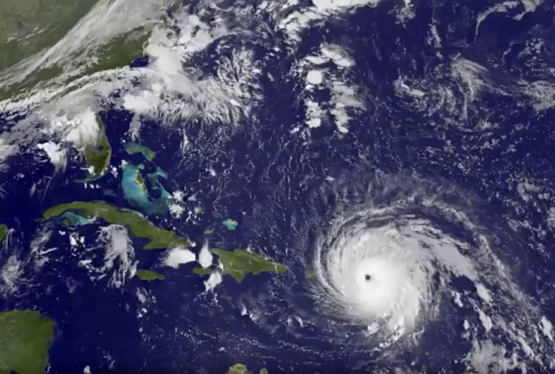
In this GOES-13 satellite image taken Wednesday, Sept. 6, 2017 at 7:15 a.m. EDT, and released by NASA/NOAA GOES Project, Hurricane Irma tracks over Saint Martin and the Leeward Islands.
( NOAA GOES Project / Associated Press )
( NOAA GOES Project / Associated Press )
Hosted by Todd Zwillich